
Major rainfall and possible storms are on the way for parts of Queensland and NSW with residents waking to icy temperatures this morning.
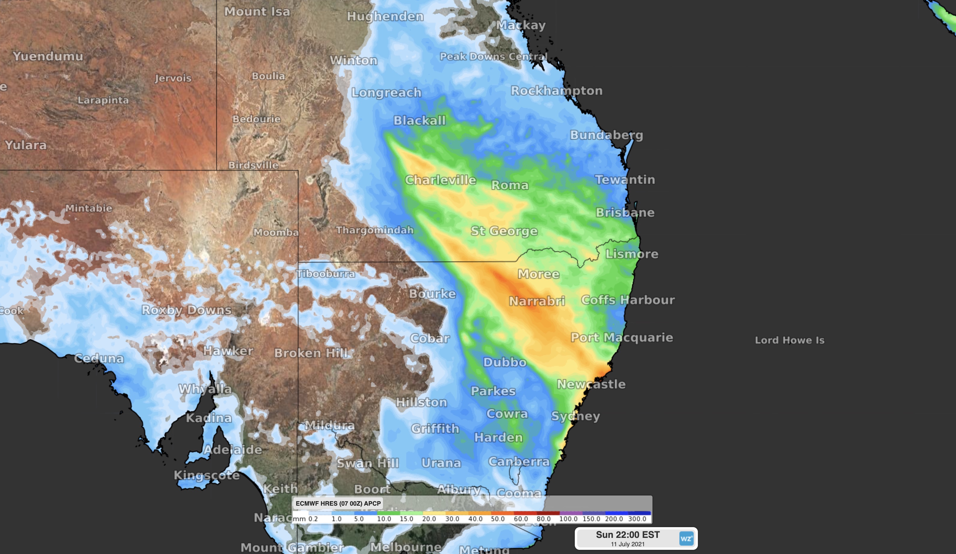
A low pressure trough interacting with moisture-laden air will cause rain and a few thunderstorms to spread over a broad area of eastern Australia between this afternoon and tomorrow.
This rain will affect areas from central Queensland down to southern NSW, with widespread falls of about 5-20mm and isolated totals over 30mm likely.
https://twitter.com/BOM_Qld/status/1412627417777254402The heaviest rain should occur over southern inland Queensland and in northern and central NSW.
As the low deepens over the Tasman, blustery winds and showers will sweep up the NSW coast over the weekend accompanied by a surge of large surf with residents warned to keep an eye on severe weather warnings.
Temperatures dipped significantly for parts of coastal and inland NSW overnight and this morning with lows of -2C in Orange, 1C in Dubbo, 4C in Port Macquarie and 5C in Newcastle.
Canberra dropped to -4C with a mostly sunny day on the way.
A trough is bringing patchy rain to western South Australia.
A high in the west is causing brisk winds to ease and showers to become confined to the coast in southern Western Australia.
from 9News https://ift.tt/2UwX5VD
via IFTTT


0 Comments