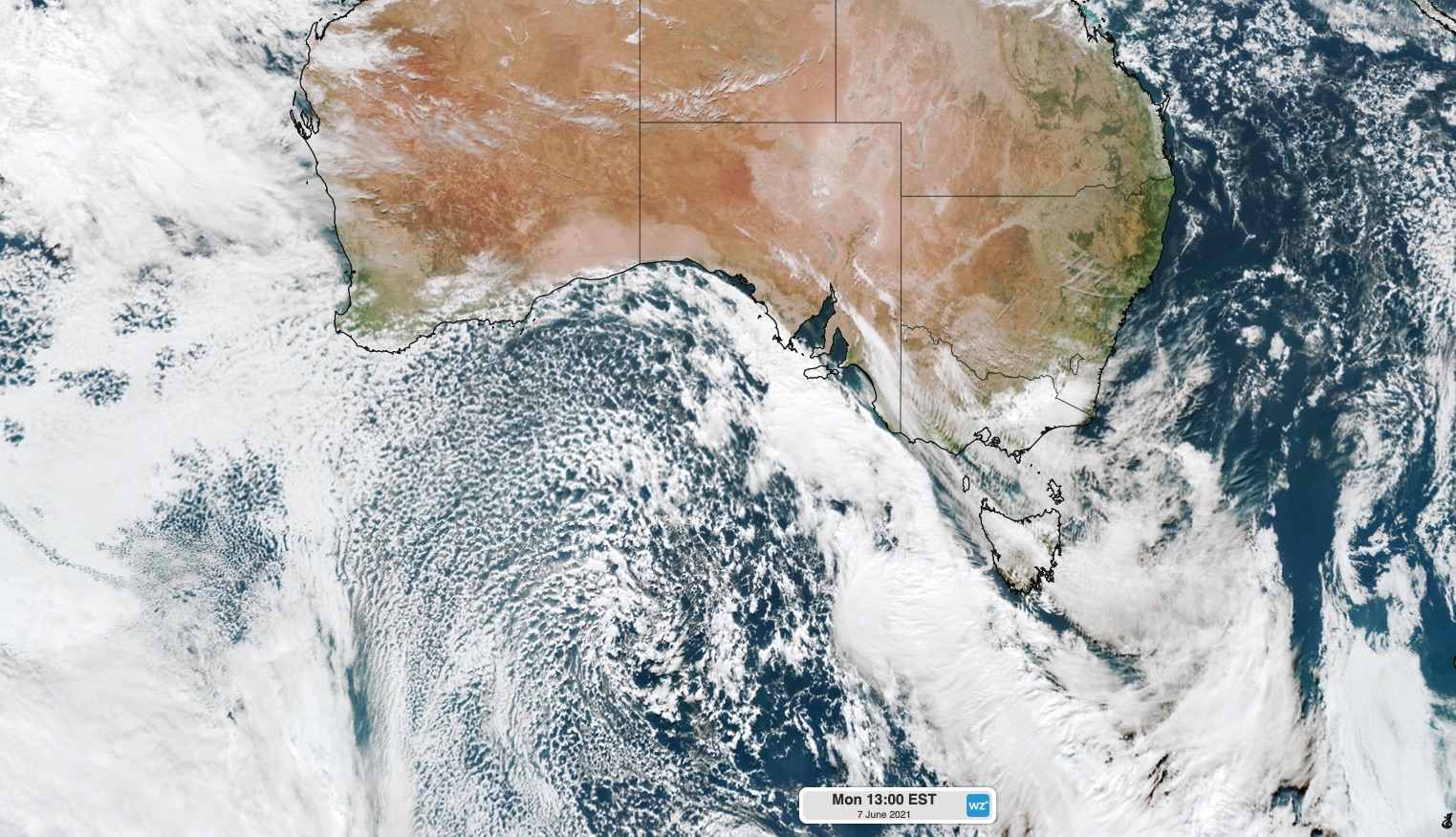
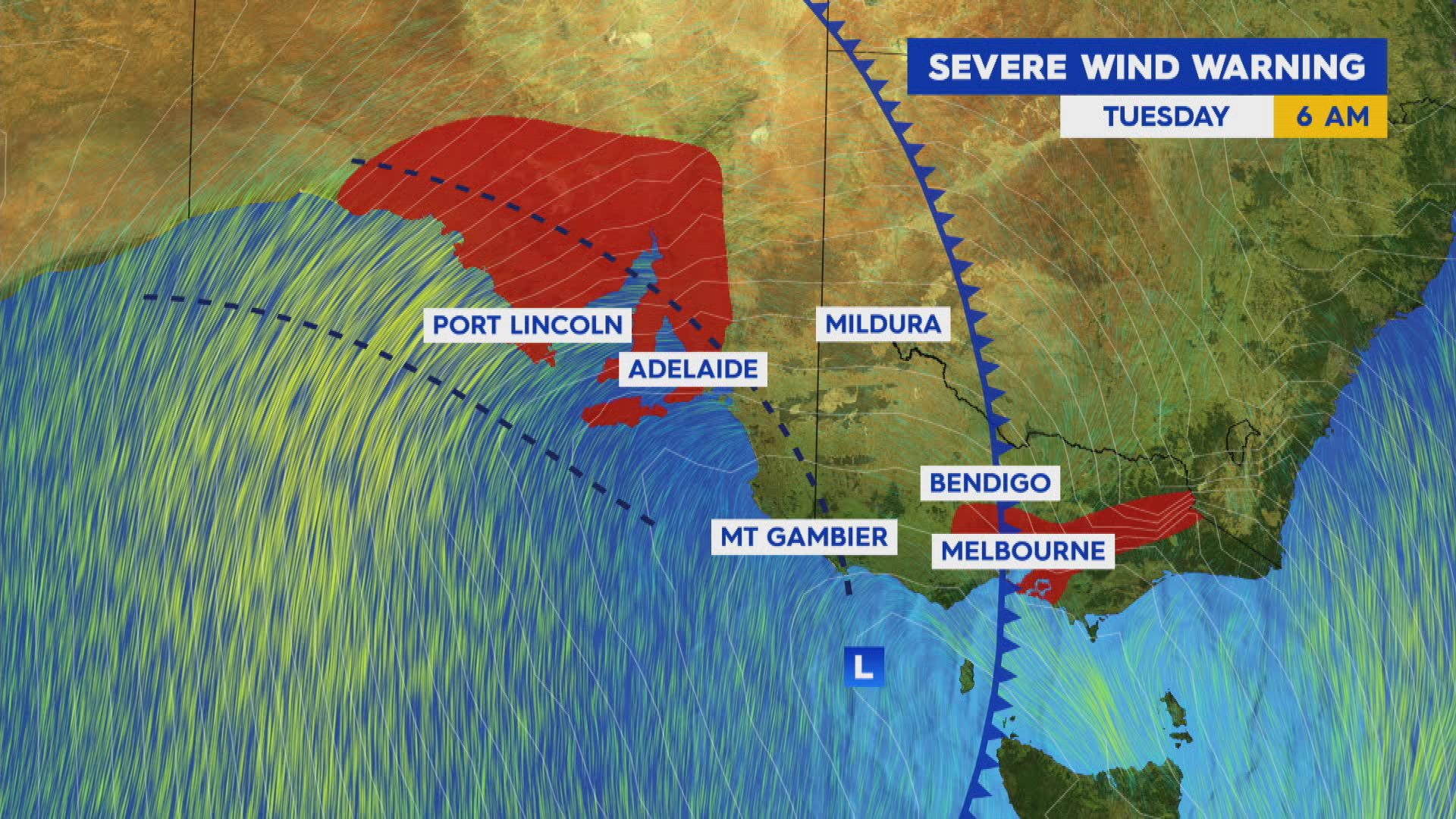
Millions of Australians living across the south east of the country have been warned of severe weather today as the first major winter storm slams several states.
Victoria, New South Wales, the ACT and South Australia are bracing for the brunt of the extreme conditions, with warnings for damaging winds, heavy rain, thunderstorms, flooding, widespread snow and hail.
The strong cold front will create a cut-off low pressure system over NSW, which will move slowly east and produce rain, storms, snow and hail across Victoria, NSW and southern Queensland.
READ MORE: Car skids off road in Sydney wet weather

"Winter is well and truly here," Meteorologist Jonathon How told Today.
"For today, South Australia, Victoria and Tasmania are going to see the wet, cold weather with plenty of hail and showers around.
"Wednesday and Thursday will be the coldest for Sydney. Fourteen on Thursday and 12 through Western Sydney as well."

The cold front will cause powerful winds in SA, Tasmania and Victoria with the Bureau of Meteorology predicting gusts up to 100km/hour in some areas.
The passage of the front and low pressure system will also cause widespread rain across SA, Tasmania, Victoria, NSW, the ACT and southern Queensland between Monday and the weekend.
The focus of the rain today will be in SA, Victoria and Tasmania. This rain may cause localised flooding in some areas, most likely in Tasmania.
Heavy rain and thunderstorms are then likely to affect eastern Victoria and southeastern NSW tomorrow and Thursday, as the low pressure system moves over Tasman Sea.
"There's plenty of wet weather on the way, possible flooding across Gippsland later in the week so keep an eye on the warnings," Mr How said.
Accumulated totals over these two days are a good chance of reaching 100-200mm and may exceed 300mm in some areas, which brings a high risk of flooding in this region.
There are even indications that 100-200mm could fall in just 12 hours overnight Wednesday into Thursday morning.
One of the main features of this weather event will be widespread, abnormally cold weather for several days and nights.
A large pool of cold air that originated near Antarctica will spread across Australia's southeastern states between Monday and Friday. This frigid polar air will send shivers across multiple states and see a surge in heater use.
Many areas in the south and southeast will be 3-4 degrees below average for at least two days this week, beginning in South Australia and then spreading further north and east on Wednesday and Thursday.
Unlike regular cold fronts, these cut-off lows often cause snow-bearing cold air to venture further north into NSW and sometimes even reaching southern Queensland.
https://twitter.com/BOM_au/status/1401722371837464578At this stage, there is a good chance of snow in the mainland Alps for several days from today.
Snow will also extend up ranges and tablelands in central and northern NSW on Wednesday and Thursday, with a chance of some snow in southern Queensland late Wednesday or on Thursday.
"We could see snow flurries across the Granite Belt tomorrow and into Thursday as well and frosty nights on the way for many Queenslanders," Mr How said.
Areas including Charleville, Roma and Emerald, places like Rockhampton and Mackay could drop to a bitter 5C - a significant change from the warmer conditions most Queenslanders are used to.
As the cold air pushes north, it may coincide with a surge of moisture and deliver a period of sustained and heavy snow in central or northern NSW on Wednesday or Thursday.
Some models suggest that more than 20cm of snow could fall in up to the northern highlands in NSW by the end of Thursday.
from 9News https://ift.tt/3fZGd1W
via IFTTT


0 Comments