
Severe storms are set to turn the southeast of the Sunshine State decidedly un-sunny today, with the strongest likelihood of storm activity from late morning onwards.
If you're heading out to vote, it could definitely pay to do it early as troughs and a front in the east will bring showers and severe thunderstorms to Queensland.
Meanwhile further south, rain and storms are likely across large parts of NSW and the ACT on Saturday, with both Canberra and Sydney in line for a soaking.
The National Capital could receive up to 60mm – in a month where it has already recorded more than triple its long-term monthly average of 62mm, with just over 130mm in the gauge so far.
Here's your state-by-state forecast for Saturday, 31 October, 2020:
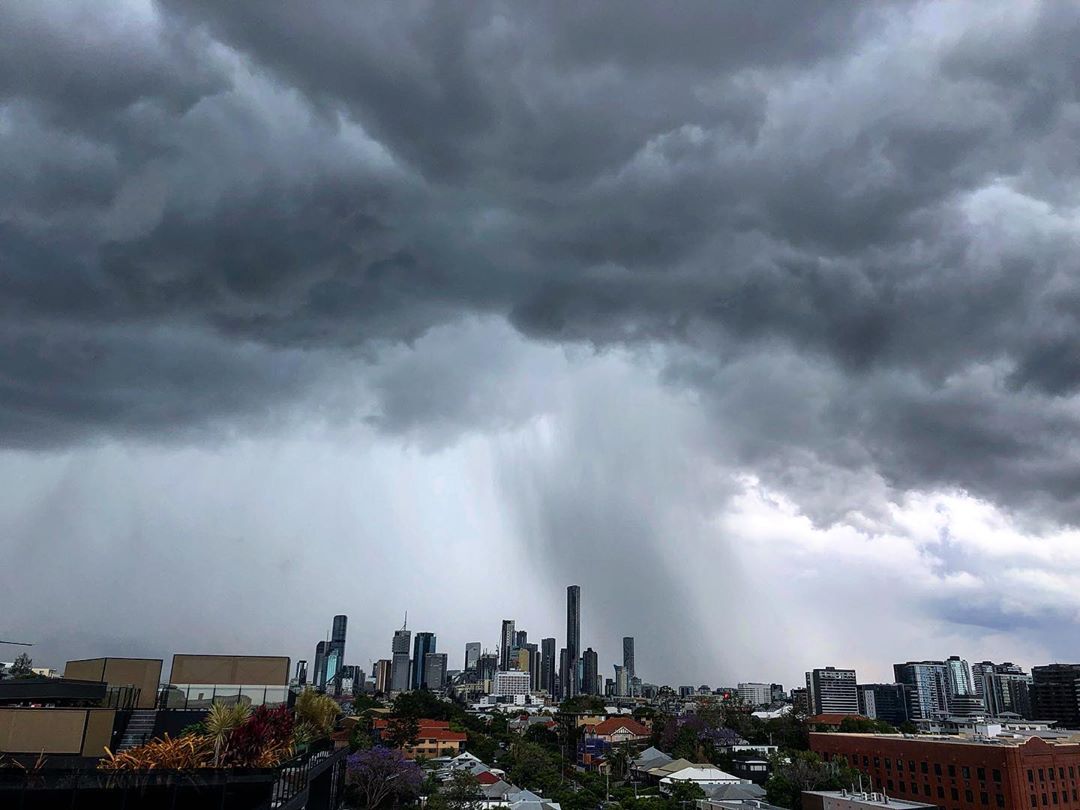
Queensland
A slight to medium chance of showers and thunderstorms over the Peninsula and east coast, increasing to a medium to high chance south of Mackay and increasing to a high to very high chance in the southeast.
Severe thunderstorms are likely south of Biloela, with a risk of damaging to destructive winds, large to giant hail, and heavy to intense rainfall. Mostly sunny elsewhere.
IN PICTURES: Lightning, hail and floods as storm season lashes eastern states
Light to moderate northwest to northeasterly winds, turning southeast to southwesterly in western districts and southwest to northwesterly in the southwest.
Temperatures above average in the north and east, tending below average in the southwest. Highs of 31C in Brisbane and 34C in Cairns.
Fire Danger - Very High in the Peninsula, Northern Goldfields and Upper Flinders, Central Highlands and Coalfields, and Darling Downs and Granite Belt Districts.
https://twitter.com/BOM_Qld/status/1322090666164441088New South Wales and ACT
A few showers and the chance of thunderstorms across much of the state, except the far northwest.
Some thunderstorms likely to be severe in the northeast and possible in central parts. Showers more persistent and tending to rain areas about the southeast, where heavy falls are possible.
Early fog patches. Daytime temperatures a little above average in the northeast, tending below average elsewhere. Highs of 15C in Canberra, 22C in Sydney and up to 30C in Grafton.
Northeast to northwesterly winds turning southeast to southwesterly across most of the State by the evening. Winds becoming fresh about the ranges, northern inland and along the coast.
Victoria
Isolated showers about southern, central and eastern areas, more scattered about the east, contracting to Gippsland in the afternoon and evening.
Isolated thunderstorms about northeastern and central northern districts until early evening.
A cool to mild and mostly cloudy day with moderate southeasterly winds. Highs of 18C in Melbourne.
Fire Danger - Low to moderate
Tasmania
Light showers about the north and northeast in the morning then about the east in the afternoon and evening.
Mainly fine elsewhere. Morning fog patches. Light winds and afternoon sea breezes.
Highs of 19C in Hobart and 20C in Launceston.
South Australia
The chance of morning fog patches about the ranges. A slight chance of a showers about the coasts of the Peninsulas, Kangaroo Island and the Mount Lofty Ranges, clearing during the afternoon.
Cool to mild in the south grading to warm in the north and far west. Moderate to fresh southeast to southwesterly winds, turning easterly in the west. Top of 21C forecast for Adelaide.
Western Australia
Showers and thunderstorms possible over the Kimberley, eastern Pilbara, North Interior, northeast Gascoyne, Goldfields and over southern and eastern parts of the South West Land Division.
Showers also developing over remaining western parts southwest of Dongara to Walpole late afternoon and evening.
Northern Territory
A slight chance of showers and gusty thunderstorms over the Tiwi Islands and western Daly Districts. Partly cloudy in the western districts and sunny elsewhere. Very hot north of Tennant Creek.
Light to moderate northwest to northeast winds, tending moderate easterly south of Daly Waters. Winds fresh and gusty through central districts during the morning.
Fire Danger - High north of Yuendumu.
- Reported with Weatherzone and Australian Bureau of Meteorology.
from 9News https://ift.tt/3213clI
via IFTTT


0 Comments