
Severe weather warnings are in place for four states today with destructive winds set to smash Western Australia and parts of the country's south coast.
Two of the strongest cold fronts this year will cause damaging-to-destructive winds, flooding rain, abnormally high tides and damaging surf in WA today.
The first cold front, which began yesterday, will strengthen today, bringing strong winds, heavy rain and icy temperatures in the south and south west.
A severe weather warning, for destructive winds and damaging surf has been issued for Lower West, South West, South Coastal, South East Coastal, Great Southern and parts of Goldfields and Central Wheat Belt districts.
Temperatures in the state's capital are expected to drop to 11C today and reach a maximum of 18C.
Some areas in the state's southwest could see gusts in excess of 125 km/h, particularly with showers and along the exposed South West Capes overnight.
Intense showers with locally heavy falls will also develop over the western coastal districts and parts of the Great Southern.
The heaviest falls are likely to occur along the coast and adjacent inland between about Perth and Bunbury, where falls of 40-60mm are possible along the Darling Range.
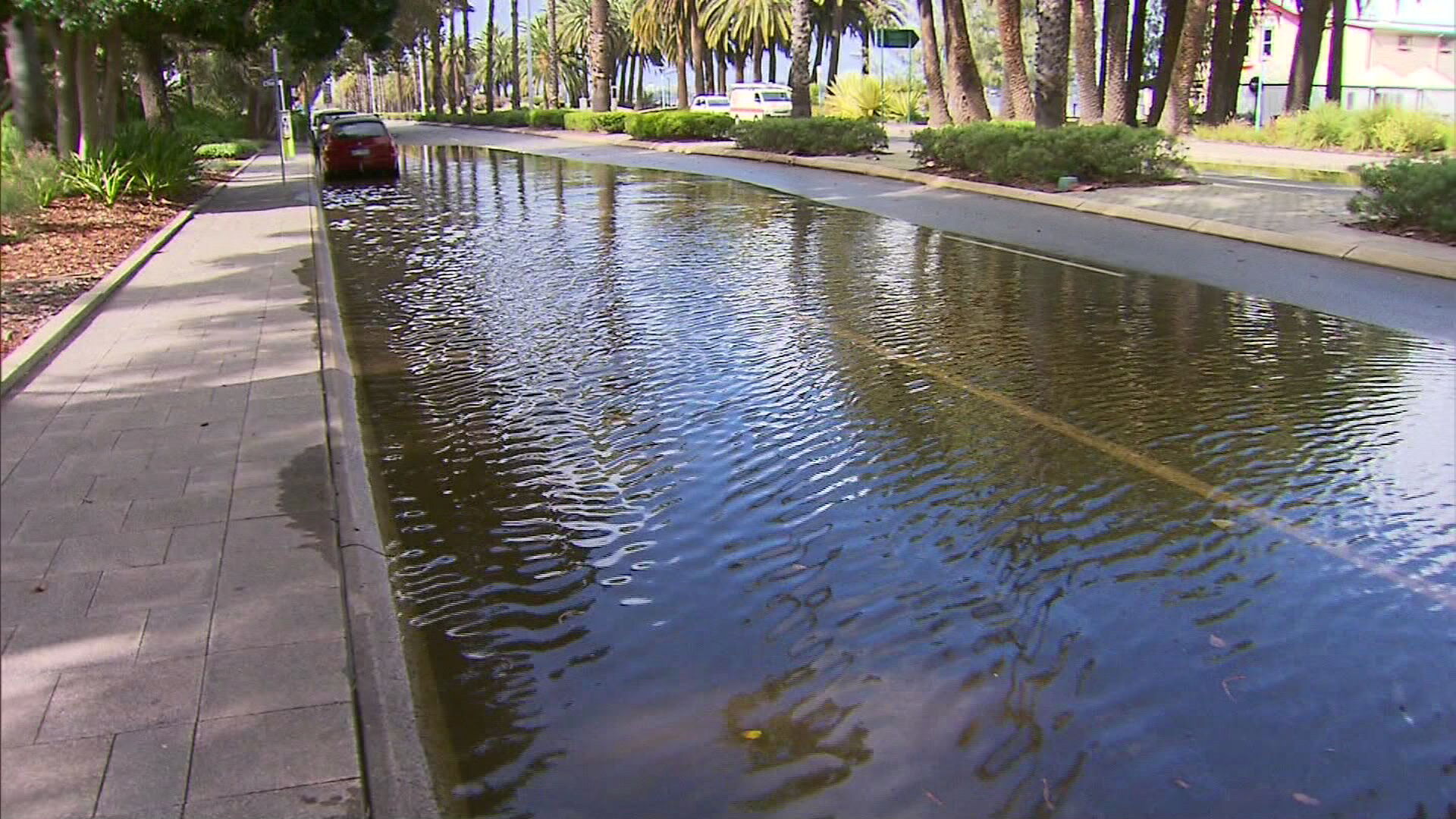
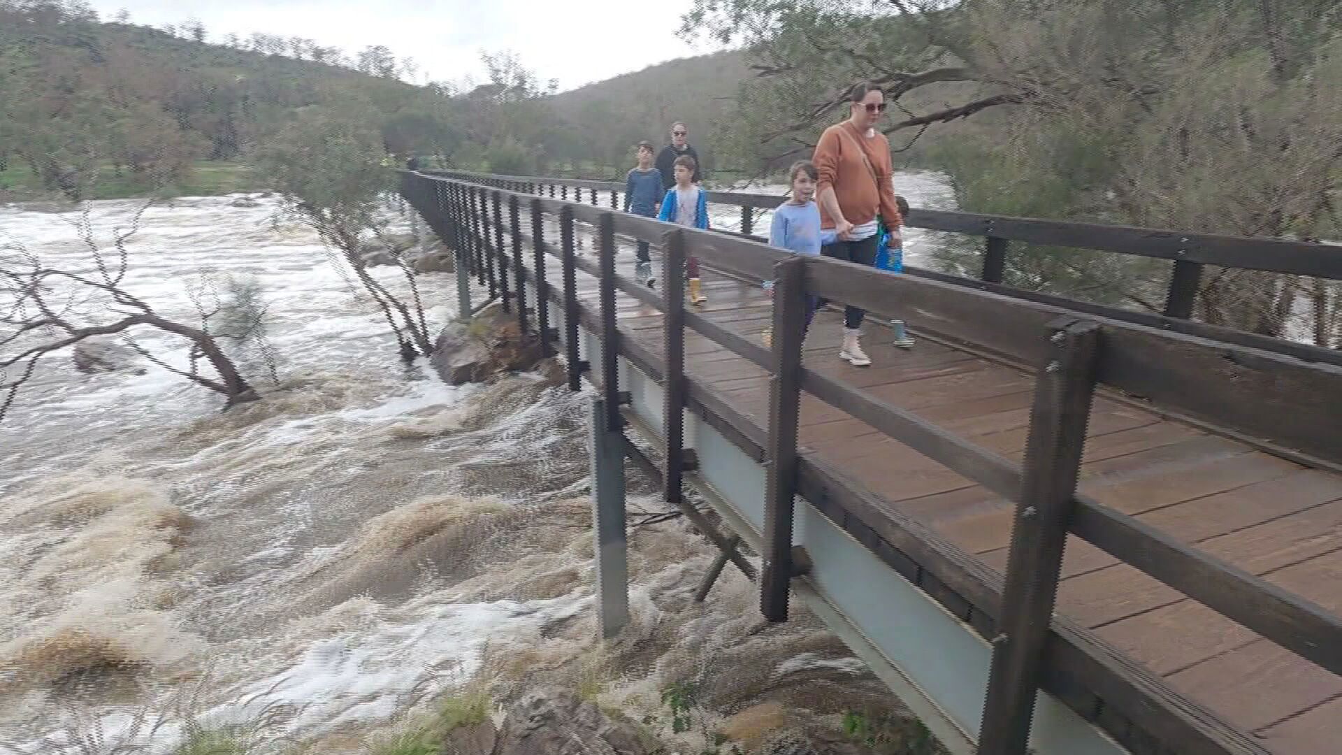
This rain is expected to cause flooding in several rivers, including the Avon, Swan, Murray and Harvey Rivers Catchments.
In addition to wind and rain, this powerful front will also cause abnormally high tides and damaging surf along most of the state's western and southern coastlines.
This may cause beach erosion and flooding in some low-lying coastal areas.
There will be some respite midweek, before another strong cold front hits the state on Thursday.
New South Wales and ACT
A severe weather warning is in place for Illawarra, Snowy Mountains and parts of South Coast, Central Tablelands, Southern Tablelands, South West Slopes and Australian Capital Territory today.
A vigorous approaching cold front will generate a vigorous northwesterly flow across New South Wales from late Tuesday evening, particularly across southeastern parts during Wednesday.
Damaging winds with gusts up to 90 kilometeres per hour are possible across the Illawarra, South Coast, Central Tablelands, Southern Tablelands, South West Slopes, Snowy Mountains and Australian Capital Territory.
For Alpine areas above 1900 metres, winds are likely to average 80 to 90 km/h with peak gusts in excess of 120 km/h from this evening.
Blizzards are also likely to develop Wednesday morning for Alpine areas above 1600 metres.
Meanwhile, the rest of the state is in for an unusually warm and settled winter's day with Sydney expected to reach 22C.
https://twitter.com/BOM_NSW/status/1419764503236030473Victoria
A northerly airstream over Victoria will strengthen this afternoon and evening as a strong cold front approaches the state from the west.
Destructive winds are forecast for the Central, South West, North Central and parts of East Gippsland, North East, West and South Gippsland and Wimmera Forecast Districts.
Peak gusts across the eastern ranges are likely to increase to 110 kilometres per hour while exposed alpine areas above 1500 metres may reach up to 120 kilometres per hour late Tuesday evening.
Damaging winds will tend westerly and continue about western, southern and northeastern Victoria during Wednesday.
Locations which may be affected include Horsham, Warrnambool, Seymour, Maryborough and Ballarat.
https://twitter.com/BOM_Vic/status/1419542111326715906South Australia
Vigorous northerly flow is developing this morning, ahead of a cold front that will move across western parts of the State and reach south-central parts late evening.
Gale force winds are expected in Adelaide as well as the Mount Lofty Ranges, West Coast, Lower Eyre Peninsula, Eastern Eyre Peninsula, Yorke Peninsula, Flinders, Mid North, Kangaroo Island, Riverland, Murraylands, Upper South East, Lower South East, North West Pastoral and North East Pastoral.
https://twitter.com/BOM_SA/status/1419555286126313472North to northwesterly winds are increasing to a damaging speed of 65 kilometres per hour from mid to late morning, with damaging wind gusts in excess of 90 kilometres per hour possible.
Winds will turn westerly and ease behind the front.
Locations which may be affected include Adelaide, Port Lincoln, Whyalla, Renmark, Mount Gambier and Ceduna.
from 9News https://ift.tt/3x7CwN4
via IFTTT


0 Comments