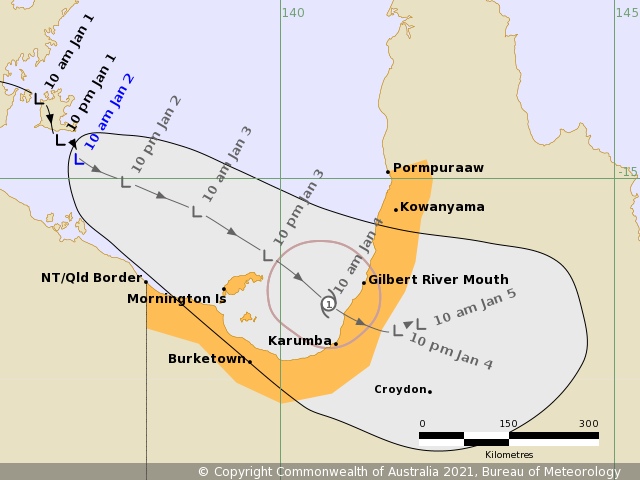
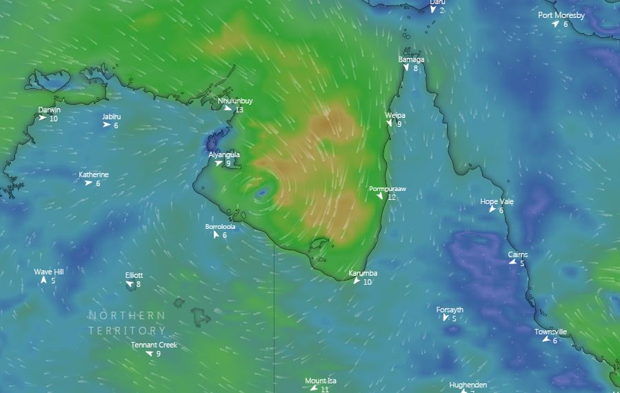
Meteorologists are watching a tropical low currently over the Gulf of Carpentaria to see if it will develop into a tropical cyclone that will impact the NT and Far North Queensland.
The low is currently 230 kilometres northwest of the NT/Queensland border and is moving in an easterly direction.
It's anticipated the low will intensify over the coming days, with the potential to develop into a tropical cyclone throughout Sunday night.
READ MORE: Cyclones, dangerous rain feared as La Niña forms

As a result, coastal and island communities between the NT/Queensland border and Kowanyama are being warned to expect wind gales over an area of 100 kilometres.
The cyclone, if formed, will also bring abnormally high tides and heavy rainfall that may lead to flash flooding.
"The tropical low may develop into a tropical cyclone during Sunday night over the far southern Gulf of Carpentaria," the Bureau of Meteorology advised.
READ MORE: First tropical cyclone of the season brewing

"The tropical low or cyclone is expected to move southeastwards and cross the southeastern Gulf coast during Monday."
Residents in the path of the weather event are encouraged to visit Queensland's Disaster Management Services website at www.disaster.qld.gov.au and to have emergency numbers on hand.
The BoM advises for emergency assistance call the Queensland State Emergency Service (SES) on 132 500 (for assistance with storm damage, rising floodwater, fallen trees on buildings or roof damage).
from 9News https://ift.tt/387810h
via IFTTT


0 Comments